Malaysia is home to many excellent hiking trails, untouched rainforests, and numerous waterfalls including Gunung Kinabalu (4095m), one of the highest mountains in Southeast Asia. And one of the coolest things about Kuala Lumpur, the country’s capital, is that there are a bunch of places that offer you miles of lush mountains, dense jungles to explore, and a perfect weekend getaway. It seems like there is a never-ending list of hiking trails that you can go on and each one is unique and beautiful. And below is the list of the hiking trails near Kuala Lumpur and Selangor that I’ve been to.
#1 Bukit Broga Hill
- Elevation: 400 meters high (1312 feet)
- Location: Semenyih, Selangor, Malaysia
- Entrance Fee: 1RM/1 person, parking 2RM (2019). Seems like the price is 5RM now in 2021.
- Facilities: car park, toilet (not well-maintained), small beverage stalls.
- Level of trek: Easy to moderate. It is suitable for casual hikers and exercise enthusiasts. It can be a bit extreme for beginners, but if you want to begin your hiking expedition, Broga Hill can be the best spot to start with.
- Estimated time: 30 minutes – 1.30 hour to go up depends on your stamina.
- Activities: best spot to watch sunrise and sunset, keep trekking to the Gunung Tok Wan Peak.
- How to get there: Car/ Grab. There are no public transportations to the foot of Broga Hill.
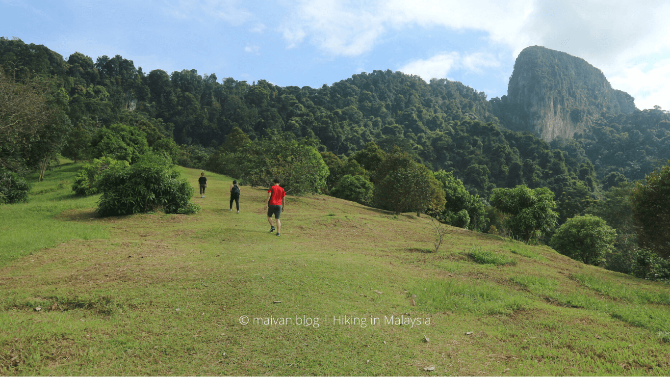
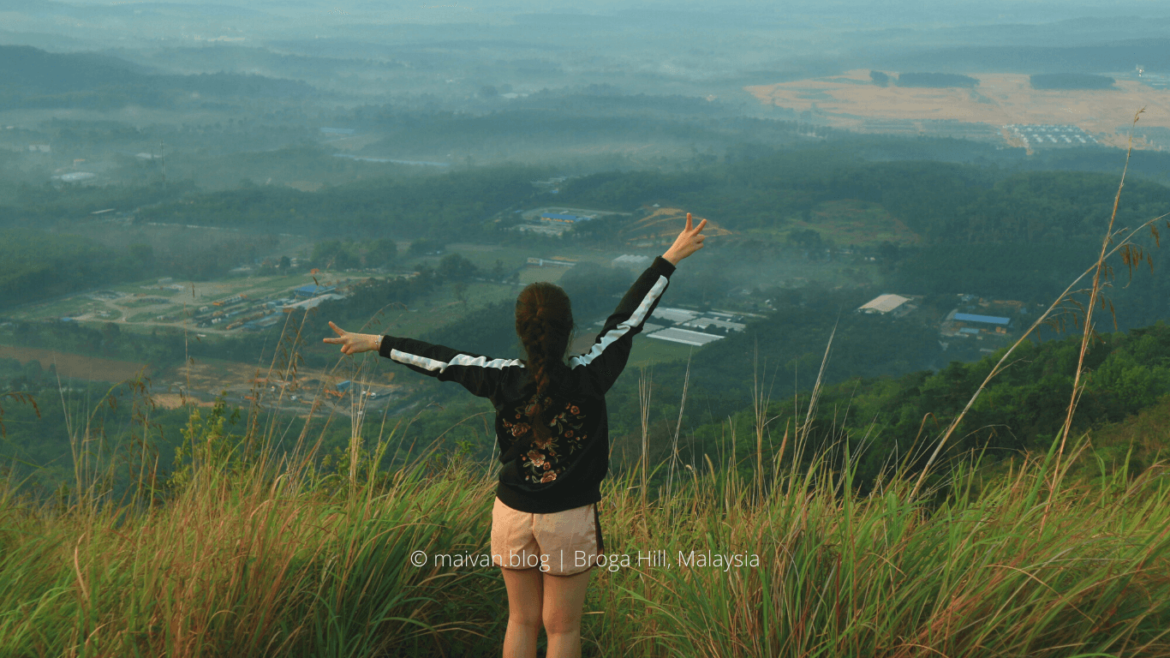
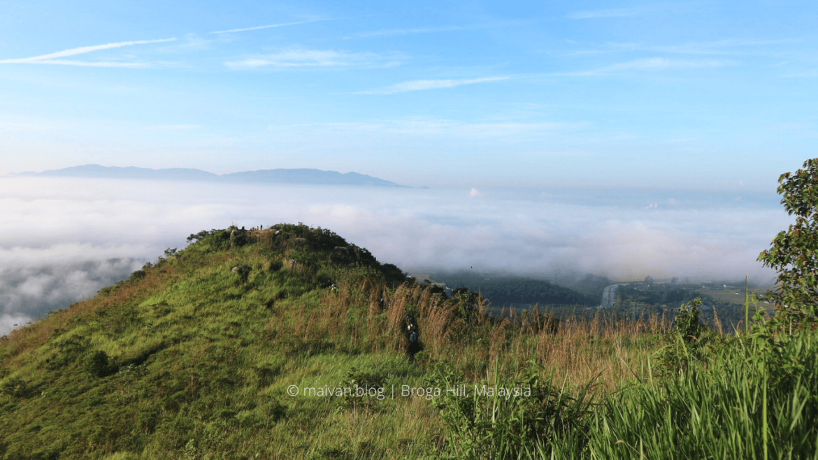
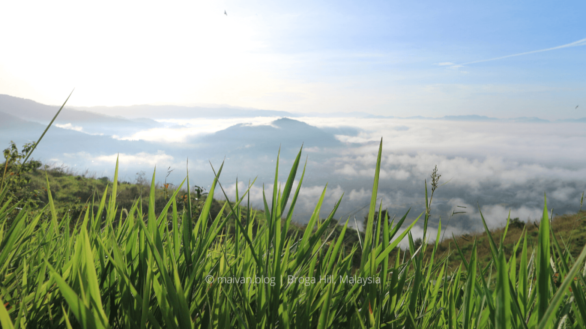
Broga Hill hiking trail is 400 meters high, which is located in Semenyih, Selangor, not far from the University of Nottingham Malaysia. It takes just around 35-40 minutes drive from KL Sentral. It’s perfect for those who don’t have much time but still want to escape the hustle and bustle of the city life. Not to mention Broga Hill is an ideal place to watch the sunrise and sunset. To chase the sunrise, you should reach the parking early, around 5A.M.
Since it’s near the University, it’s always crowded with students climbing in the morning and on weekends. And Broga Hill might be the most crowded trail I’ve ever been to.
The early stages of the Broga are enjoyable and not too tiring, but as you reach higher up, it gets more challenging. And it can be a bit muddy and slippery after the rain.
Broga Hill has 3 peaks. The first two peaks offer a breathtaking panoramic view of the Broga area and its surroundings. At the end of the third peak, you can turn right to follow the direction of Paradise valley, it will lead you to people’s farms, the villages, there are some nice local restaurants there. Or from there, you can turn left to continue to Gunung Tok Wan.
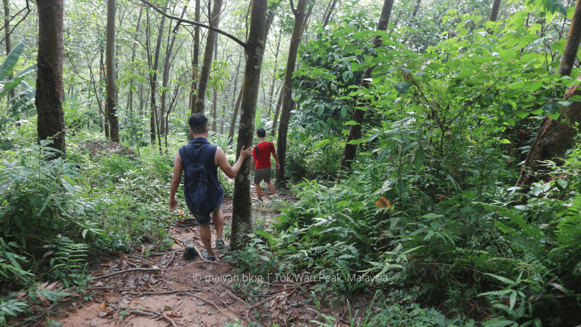
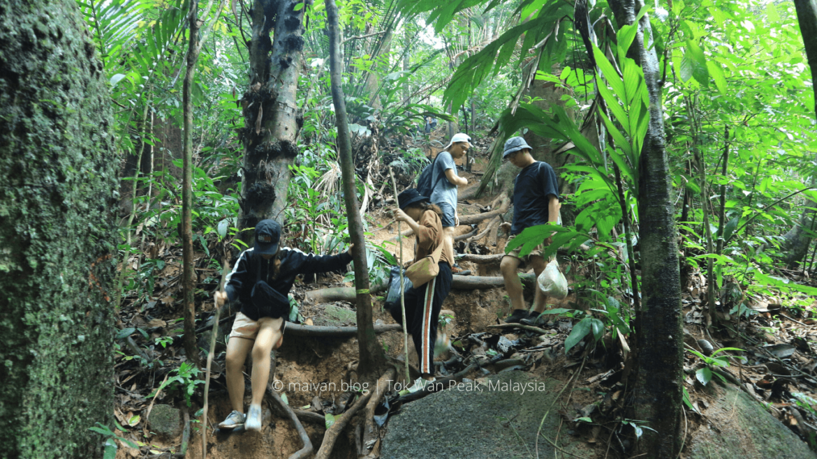
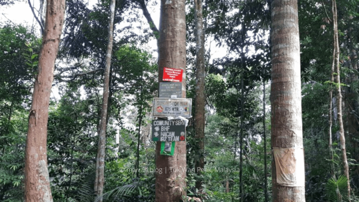
#2 Gunung Tok Wan Peak
- Elevation: 675 meters (2,215 feet)
- Location: Semenyih, Selangor, Malaysia
- Entrance Fee: Same entrance with Broga Hill
- Facilities: big car park, toilet (not well-maintained), small beverage stalls.
- Level of trek: Easy to moderate. You can’t hike Gunung Tok Wan without hiking Broga Hill. You should not continue hiking Gunung Tok Wan if you are exhausted after climbing Broga Hill because Tok Wan is a long trek.
- Estimated time: From 1-2 hours one-way from Broga Hill.
- Activities: Gunung Tok Wan is a continuous trail from Broga Hill. No view on the top of Gunung Tok Wan
- How to get there: Car/ Grab.
Gunung Tok Wan, 675 meters above the sea level, is located in Semenyih, Malaysia. The trailhead is located just beyond Broga Hill’s peak. It is quite easy to trek because the trail is relatively flat, but it is quite a long and exhausted trek. It might be a bit more tiring compared to trekking Broga.
After conquering Broga Hill, Gunung Tok Wan will be another challenge for you to test your endurance and stamina. Since there is no view on the top of the mount, not many people hike it and it’s less crowded than Broga Hill. The trail is mostly flat to begin with. You’re going to go through the bushes and trees, and there will be several up and down routes.
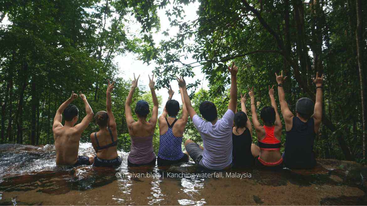
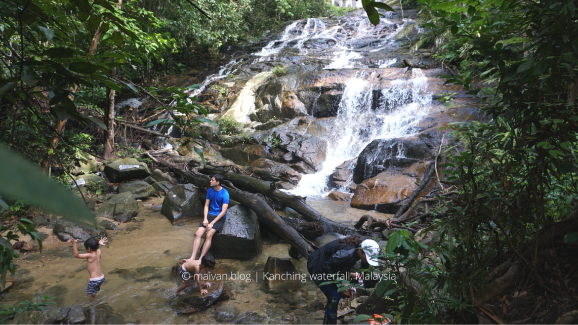
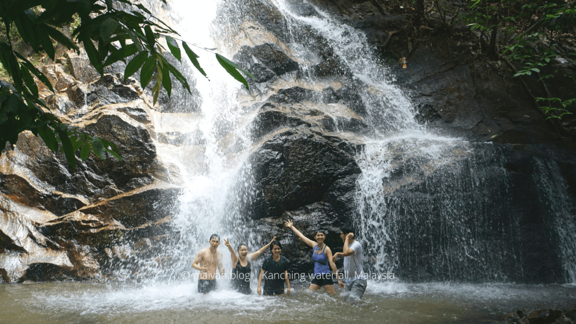
#3 Kanching Waterfall
- Open: 7.30am-7.30pm daily
- Level of trek: easy to moderate
- Entrance ticket: RM5.5/expat (2017), 2RM for Mycard. You can check updated ticket prices here .
- Facilities: car park (2RM/ car, 1RM/ motorcycle), the park and shelters for picnic, toilet & changing rooms on levels 1-4, shops in front of the car park.
- How to get there: Car/Grab, motorbike or bus. You can check the bus schedule here.
- Activities: The waterfall is a great spot for a picnic, camping, swimming, and jungle trekking. If you want to avoid the crowded, go on weekdays, trek in the early morning, and swim on the higher levels.
- Caution: the higher trails require your attention to every step since they are very slippery. Wild monkeys are aggressive, they start tailing you and stealing food, so be careful.
Kanching Rainforest Waterfall or Kanching Recreational Forest is located in Rawang district, the north of KL. It is a popular getaway spot for local people on weekends. There are 7 tiers in Kanching waterfall which are well maintained: level 2 – 102m, level 3 – 120m, level 4 – 140m, level 7 – 208m. It is not really high but it may be dangerous because the trails are quite steep and slippery.
The waterfalls consist of seven levels. The lower levels are suitable for families and children. If you want to trek to the jungle, go upper levels. There is a very nice stream at the end of the trail. It is a sandy and shallow stream, pretty cool!! We decided to stop, had a picnic, and chilled next to this stream. After that, we went back to level 7 to dip our bodies in the cool water; it is a great way to escape the summer heat.
The route to the first four levels of falls is cement footpaths and steps. It is quite easy at first but then, at these levels, you will pass a troupe of monkeys foraging and fighting for food from passing visitors. Be aware of them because some are extremely aggressive, they did steal our food and scare us away:)
Check out more pictures of Kanching Waterfall here.
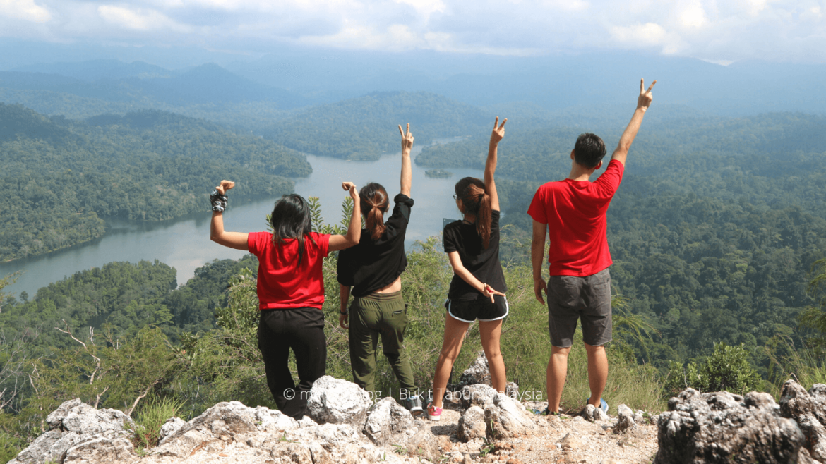
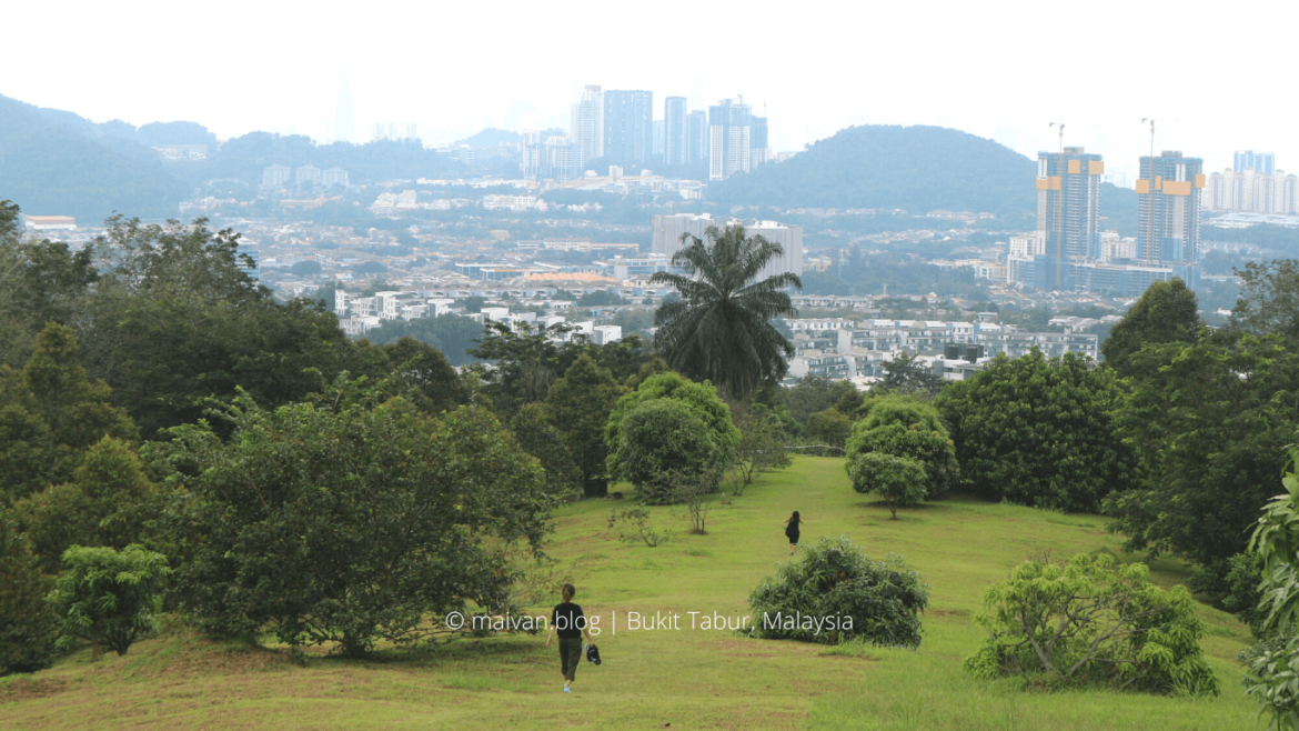
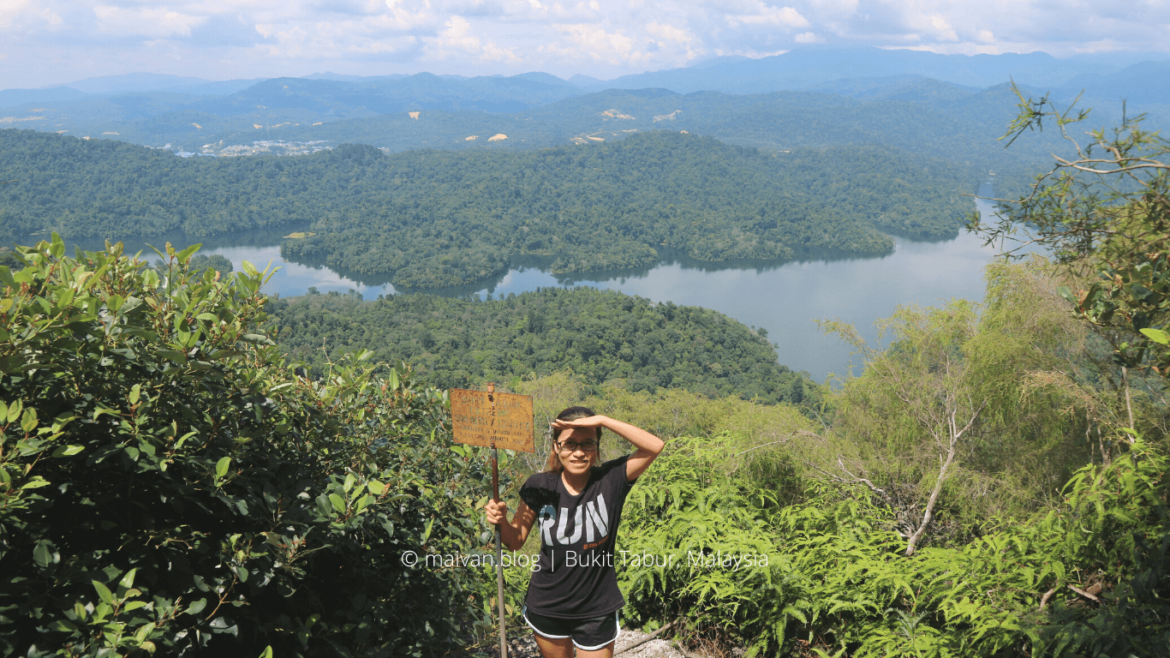
#4 Bukit Tabur
⚠️⚠️⚠️NOTE: BUKIT TABUR IS RESTRICTED NOW (UPDATED 2021) ⚠️⚠️⚠️
- Location: Bukit Tabur( Tabur Hill) Taman Melawati, 30 minutes drive from KL Sentral.
- Height: the Far East peak: 375m, The East peak: 275m, The West peak: 446m, The Extreme peak: 396m,, you can try many peaks at the same day to challenge your stamina and endurance, and the fabulous view of Klang Gate Dam is worth your effort, believe me!
- Level of trek: moderate to extreme
- How to get there: There is no public transport available to travel to the hiking spot so you can go by taxi or drive.
- Best time to climb: from 7A.M- 8A.M, if you want to watch the sunrise, you may start sooner around 5.30 A.M
- Highlights: It’s a difficult trail, thus you should wear comfortable clothes, bring enough water, some snacks, a camera to capture fabulous views from the top, and don’t forget to bring with you a steady head and a strong heart.
- Hiking duration: depends on how experienced and fast you are, for each trail it may take about 1 – 2 hours to reach
- Note: the trail is usually closed due to its danger, do check if it is accessible before your trip.
Bukit Tabur hiking trail is less than 500 meters, but it is not easy to hike at all because of the sharp tone along the way up. There are some difficult straight-up trails that you seriously need the help of ropes and you have to really take care of your every step. Due to that difficulty, you sometimes feel like giving up and stop halfway on the trail, and you know what, those motivational quotes will definitely cheer you up.
There are 2 main trails in Bukit Tabur, the West trail, and the East trail, besides there are far East, Extreme, Extra trail. There are some rock cliffs in the trails where the hikers have to hold the ropes, use both hands and legs to climb up. However, the top of the mountains always offer a panoramic view of the Klang Gates Dam and the city; if you are really into hiking, these trails will definitely satisfy you.
The most interesting thing is that you will incidentally catch up on a lot of inspirational quotes hung up in the middle of the trails. These quotes give you a big motivation to keep going and reach the top of Bukit Tabur.
Check out more pictures of Bukit Tabur here.
⚠️⚠️⚠️NOTE: BUKIT TABUR IS RESTRICTED NOW (UPDATED 2021) ⚠️⚠️⚠️
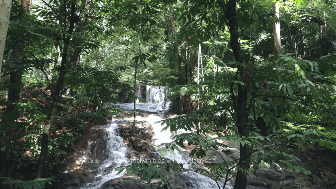
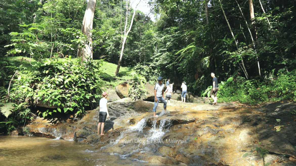
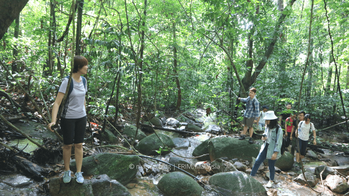
#5 FRIM (Forest Research Institute Malaysia)
- Open: Monday – Saturday from 8.00 am – 5.00 pm
- Entrance fee: there is a small entrance charge for entering the FRIM: RM1/ person (2018)
- Level of trek: Easy
- How to get there: 30 minutes by cars/ Grab from KL Sentral. By public transportation, you can take KTM to Kepong Sentaral Station (after Kepong station) and then take a taxi to the FRIM’s entrance.
- Activities: jogging, hiking, swimming, out doors activities, team buildings, family hangout, cycling, camping, vacation.
- About FRIM : Forest Research Institute Malaysia, 52109 Kepong, Selangor Darul Ehsan, Malaysia. FRIM, founded in 1929, is one of the leading institute of natural forestry research in the world.
FRIM is more than just a jungle trekking, it caters the interesting outdoor activities and the adventurous trip as well. There are various activities that you can do in FRIM like camping, team-building activities, visiting Botanical Garden and Malaysian traditional houses, trekking to the nature rivers, waterfalls, walking over the canopy walkway, etc.
FRIM is suitable for your run-away weekend, you can spend your day here jogging, camping, riding a bike around, or simply enjoying the fresh air here. It is also a perfect place for family gatherings since it’s safe for kids. Renting a bike would be a great recommendation, the rental fee is RM10 or you can also book for 60 -90 minutes eco-tour around FRIM. You can check out the FRIM official website for detail information and activities.
Check out more pictures from FRIM (Forest Research Institute Malaysia).
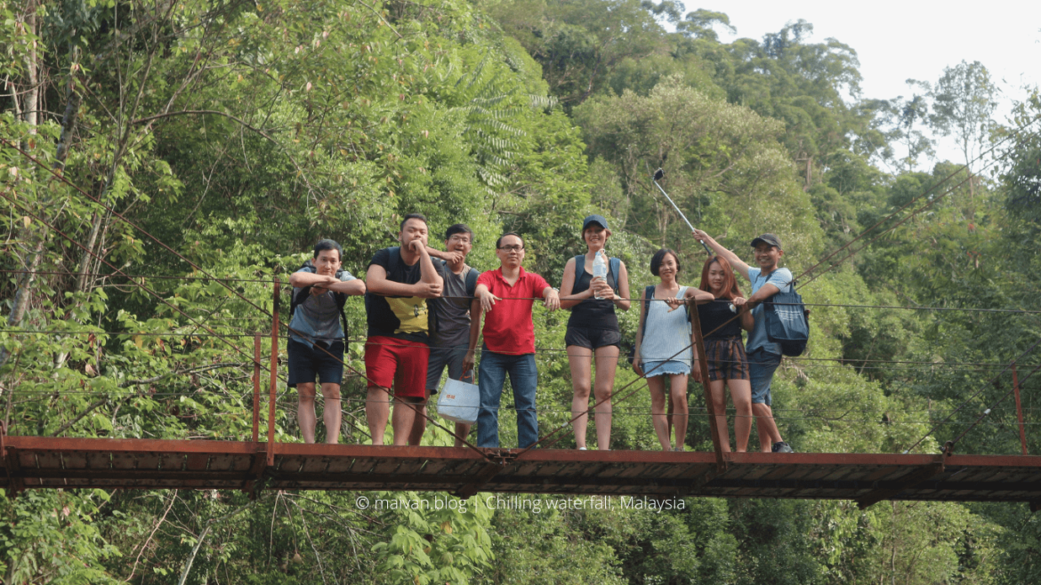
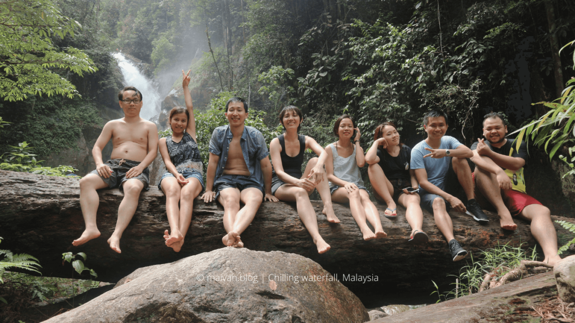
#6 Chilling Waterfall
- Entrance fee: RM1/person (2018)
- Before your trekking to the waterfall, at the entrance, you have to claim how many bottles and plastic bags you are bringing with and remember to bring back from the waterfall to claim back.
- Travel by: Car, Uber, Grab, KTM ( Kubu Bharu).
- Level of trek: Easy
- Activities: camping, trekking, swimming, exploring the jungle.
- Note: seems like it is closed now (12/2021). Please check if it is accessible before your trip
We took Uber to Chilling waterfall for around RM220 for 9 people ( it took around more than 1 hour to reach the fall from KL Sentral). On the way back, it was no Uber/Grab available, so we went to Kubu Bharu KTM by taxi (RM80 for 9 people) and took KTM to KL Sentral (around RM6/person). There are just a few schedules a day, so if you travel by public transport like us, make sure that you leave before evening and Check out this site for more info about the KTM schedule.
It is a great spot to picnic, gather and camp on weekends. Right at the 1st cross, there are many shelters where you can have a picnic with friends or family, there are also some fast food stalls around that you can enjoy after the trekking trip. Besides, there are many spots where you can set up an overnight campout right next to the beautiful stream.
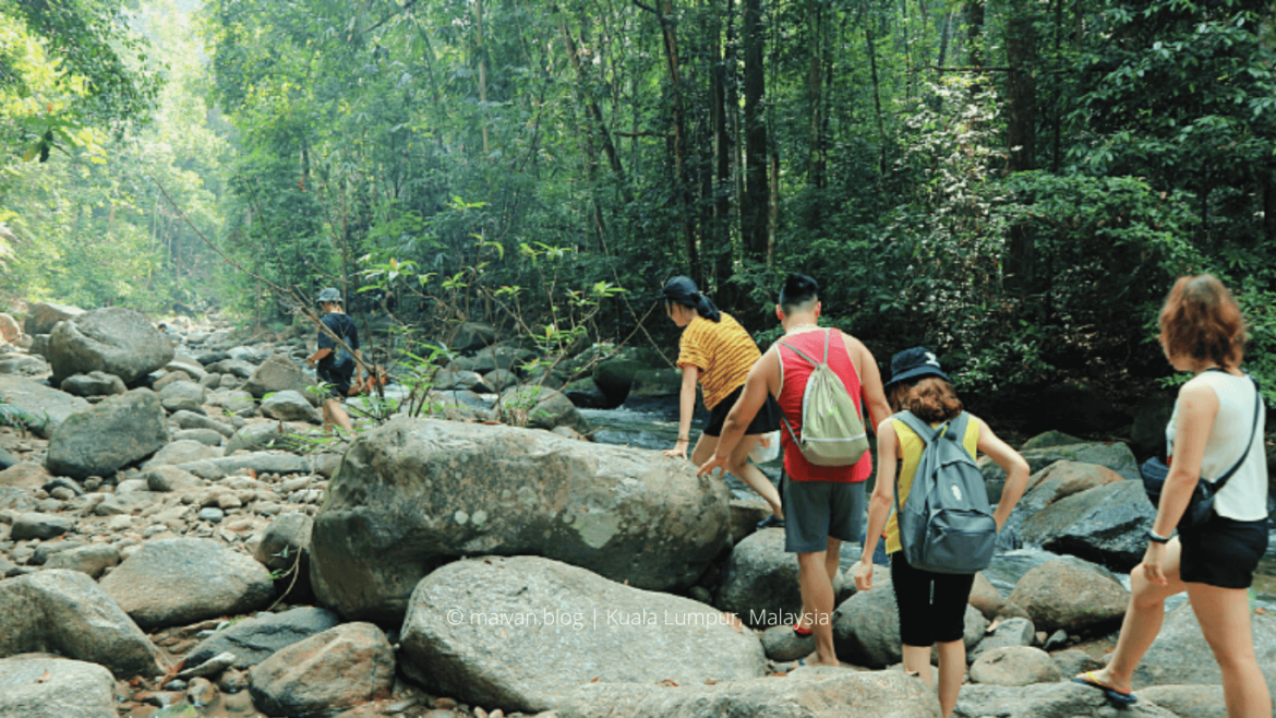
It would be a great weekend trekking trip for nature lovers. The Chilling Fall is probably one of the most beautiful and enormous waterfalls of Selangor. You will reach the waterfall after an adventurous trek along the river with 6 river crosses. The further crosses you go, the more challenging and difficult the crosses are. However, it’s not that hard when the water level is low during the dry season.
Check out more pictures of Chilling Waterfall.
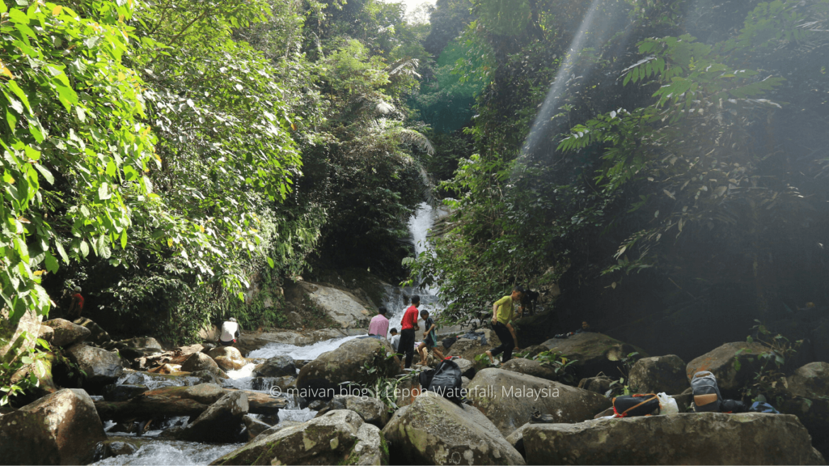
#7 Sungai Lepoh Waterfalls
- Location: 43100 Hulu Langat, Selangor. You can aim for Asli Adventure Base Camp on Google Map.
- Level: Easy
- Entrance fee: 5RM/ person.
- Estimated hiking time: about 40 minutes – 1.30 hour one-way.
- Facilities: toilets, many restaurants, man-made pools (Asli Adventure Base Camp), parking lot, camping site.
- How to get there: Car/Grab, it takes you about 1 hour to reach the spot. You can also get there by bus. You can take the MRT to Taman Suntex Station, walk to the bus stop Kj38 Taman Suntex and take the T406 bus. To save our time looking for the entrance, we took Grab to the waterfall entrance and then took the bus on the way back.
- Activities: hiking, camping, picnic, swimming.
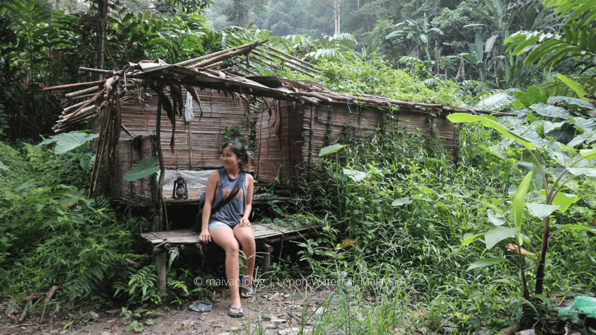
Lepoh Waterfalls or Air Terjun Sungai Lepoh is an easy trail suitable for beginners and this is a pretty famous camping spot for locals, a good place for relaxation and family gathering. Asli Adventure Base Camp is the entrance of the trail, you might want to stop here to enjoy the food or swim in the man-mad pool after the waterfall excursion.
At the entrance, visitors are required to record their information at the registration counter before starting their trip. On weekends, there are quite a lot of campers on the upstream and quite crowded at Base Camp.
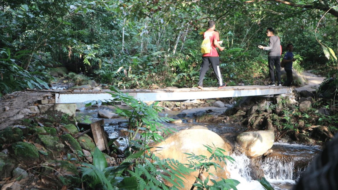
It is fairly easy for the first 1-2km as you pass through 2 small wooden bridges and wander around the orchards, bamboo trees, and rubber plantations. After that the is a bit steep but relatively easy for everyone. After passing the dilapidated hut and the large water pipe, you are almost at the waterfall.
There is a big waterfall on the top, the waterfall is safe to swim in. A few people continuously hike after reaching the fall, but we decide to stop at the waterfall, have a tiny picnic, and purely enjoy the chill waterfall.
#8 Chamang Waterfall
- Location: 68, 28750 Bentong, Pahang. It is around 1.10 minutes drive from KL Sentral, a little far compared to other spots.
- Entrance fee: 3RM/ person (2018)
- Facilities: Toilets, changing rooms, huts, restaurants, café, food and beverage stalls, parking lot, BBQ areas.
- Level of trek: Easy
- How to get there: Grab/car. There is no public transport available to travel to the Chamang waterfall
- Hiking duration: the waterfall is right at the entrance:), it takes you about 10 minutes to wander around.
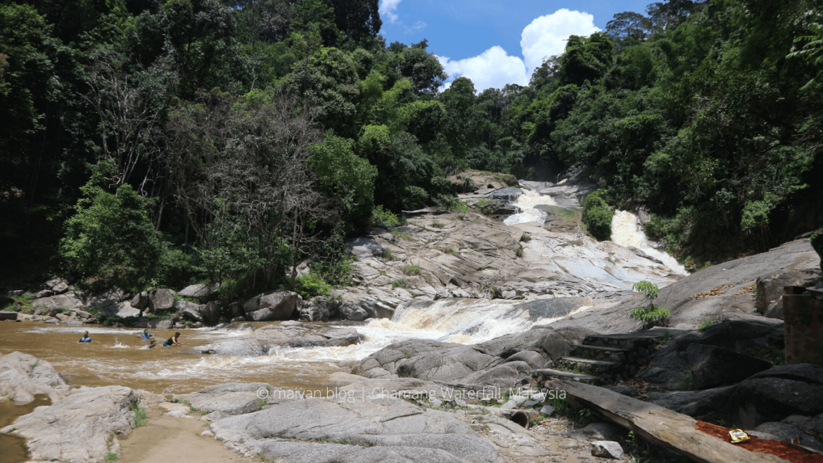
OMG! The waterfall right in front of the parking spot:)) it might be a perfect place for those who love nature but do not want to hike. To me, this is the most disappointing trip:) I always expect a challenging hike to sweet off my calories.
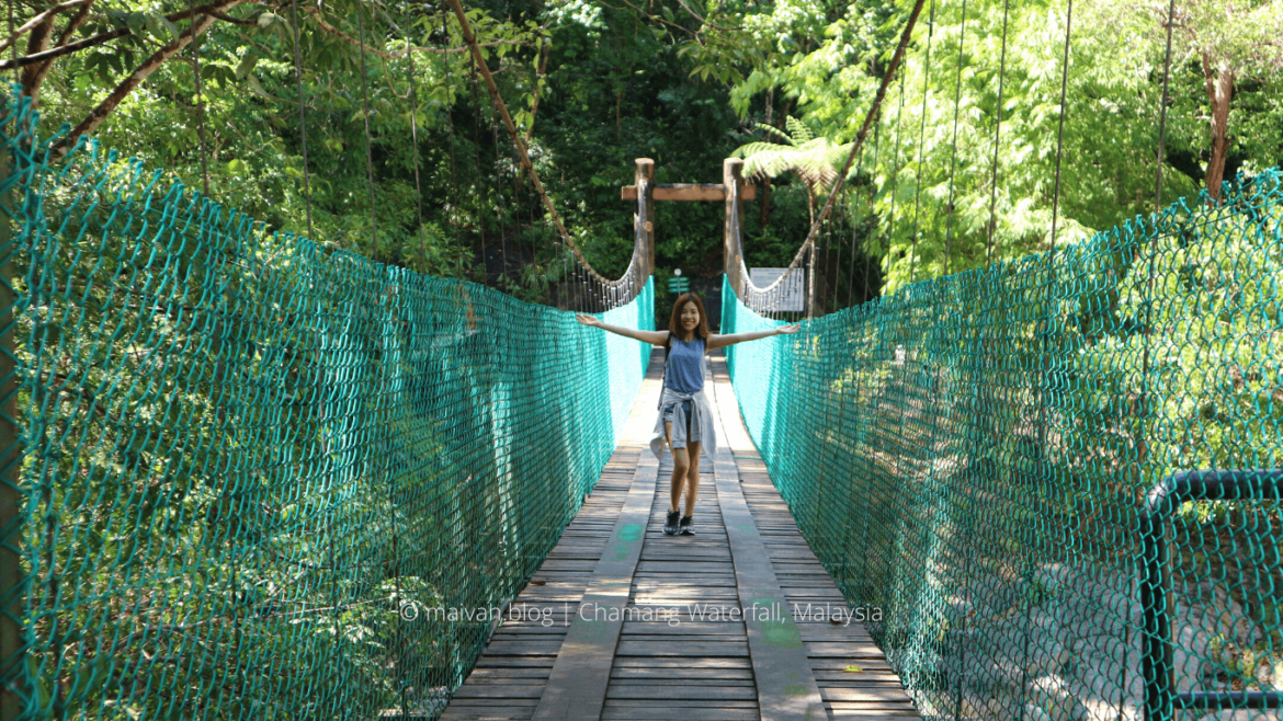
Even though, Chamang waterfall is a huge and majestic waterfall with amazing and peaceful surroundings. It is a great spot for a family gathering, picnic, BBQ, and swimming. There is a beautiful suspension bridge that connects to the opposite side of the fall, you might want to explore this side of the fall where is more of nature and less crowded.
In summer, it can be a perfect place for dipping your body in the chill water here. But the water volume might be much different during raining season. It can be too dangerous to swim during this time when the waters are gushing down violently at tremendous speed and too nasty.
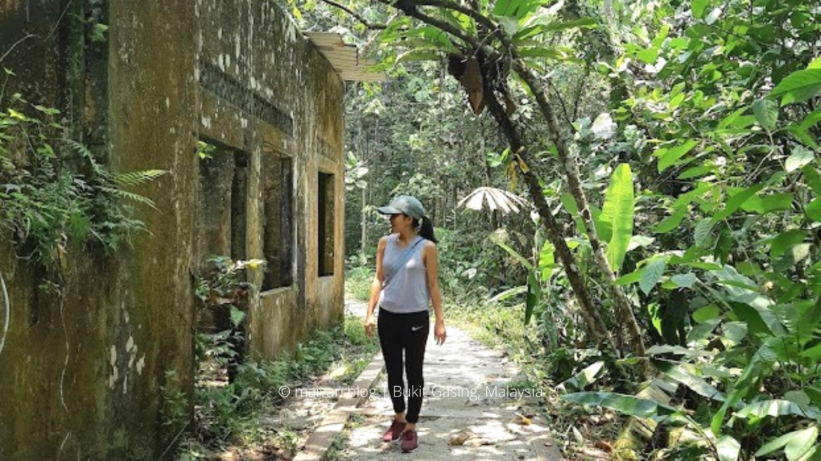
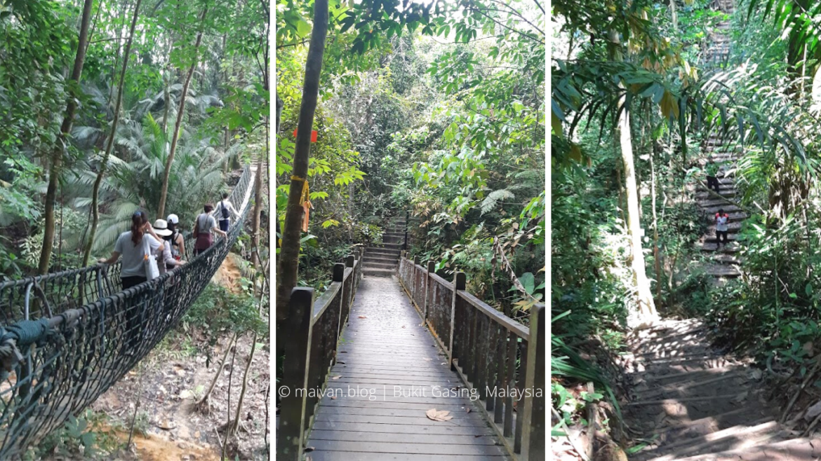
#9 Bukit Gasing
- Location: Right in the middle of center city. Bukit Gasing is a tropical forest park located on the borders of Kuala Lumpur and Petaling Jaya.
- Facilities: parking lot, toilet, beverage stalls at the main entrance. There are shelters, BBQ area at the Taman Rimba Bukit Kerinchi. Many rest areas with benches along the trails.
- Level of trek: Easy to Moderate
- How to get there: Grab/ car. If you are nearby residents, you can walk there. Bukit Gasing used to be my casual weekend exercise, it took me around 35 minutes walking from Petalz Residences to the main entrance.
- Hiking duration: there are too many different trails for you to choose from, it can take around 30 minutes to a couple of hours if you do multiples paths.
- Activities: jogging, hiking, picnic, BBQ, family gather, photography.
Bukit Gasing is a casual hiking spot for nearby residents to do some jogging on weekends. Thus, it is advisable to go during weekdays to avoid the crowd.
There are many different trails in Bukit Gasing which suit all of the levels of stamina and fitness: flat paths, stairs, cement walkways and challenging slopes. All the trails are well-marked, the park is also well-maintained compared to others places that I’ve been to.
There are many different entrances to access the park. You will properly find the main entrance which is marked on Google Map as Bukit Gasing Parking and Toilet where there are parking lot, toilets, and some beverages stalls available here. Another big entrance is Taman Rimba Bukit Kerinchi where the parking lot and toilet are also available and it is directly accessed toward the picnic area and the Steel Bridge.
Overall, it is a nice trail for everyone, for family gather, a weekend picnic. It is a good try for beginners and a regular training section for casual hikers.
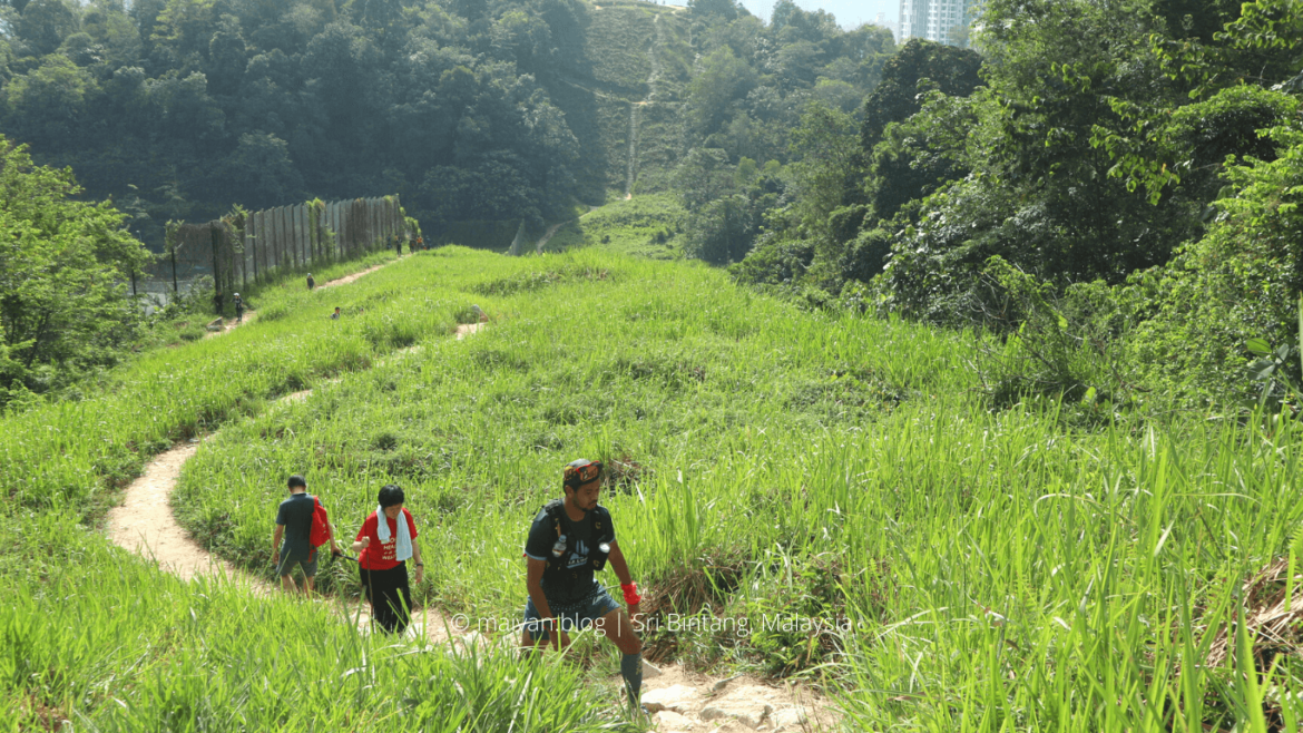
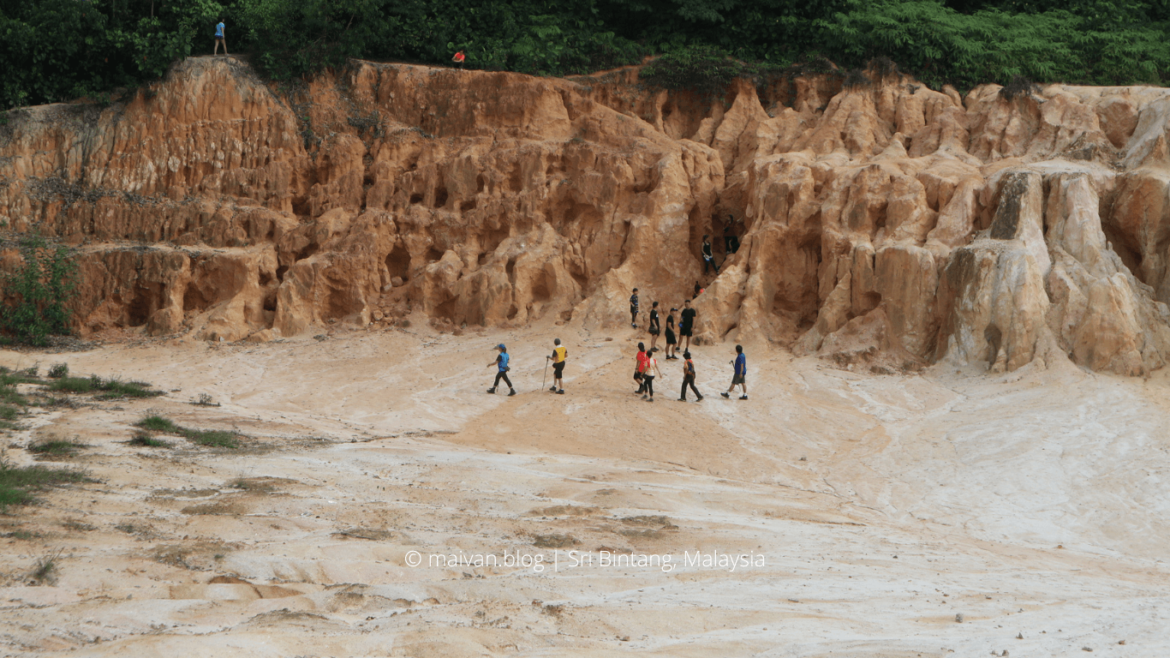
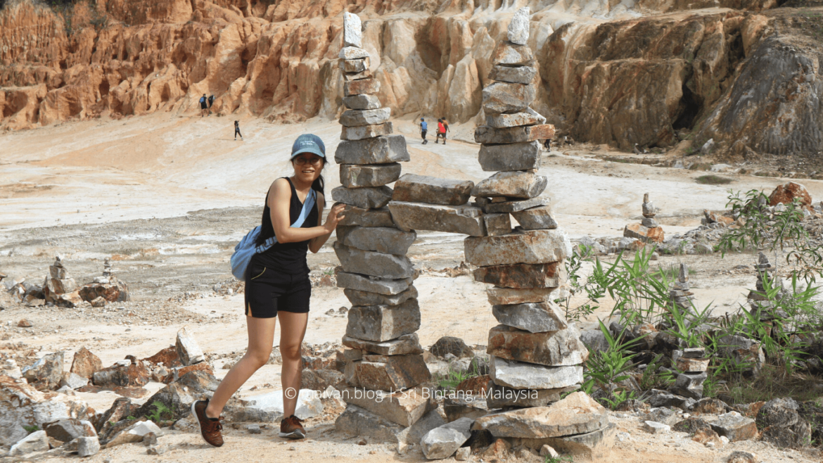
#10 Bukit Sri Bintang
- Trail: Bukit Sri Bintang, Kepong
- Distance: 3.5 kilometers
- Duration: 1-2 hours continuously trek.
- Level: Easy hike, but good enough for a weekend workout.
- Entrance fee: Free
- Starting point: Jalan 11/36 Taman Sri Bintang. In Googlemap, searching for “Sri Bintang Hill Trail”. There are 2 starting points at the Jalan 11/36. The left stairway leads to 1st peak. The right path leads to the 2nd peak.
Bukit Sri Bintang is not far from city center, only 20 minutes drive from KL Sentral. It is a bit crowded in the early morning, as crowded as Broga Hill, I suppose. There are multiple trails at the hills and all are well-marked.
Bukit Sri Bintang is actually the twin peaks of a hill. It takes around 30 – 40 minutes to reach peak 1 and another 15-20 minutes to peak 2.
There are some challenging paths with support ropes along the way. However, there will always be another path to reach the spot if you do not want to challenge yourself. Most of the trails are not too long compared to other trekking trails in Kuala Lumpur, so do not be afraid of being lost, you will definitely find a way out.
When you reach the 1st peak, don’t miss the ‘yellow valley’ on your left. It is more like a wasteland valley where many beautiful shapes are formed caused by extreme pressure of water or wind during the rainy season, I guess. There are some different ways heading to the yellow valley. Choose your favorite one and head up to the valley to take some good pictures there. Save some sweet memories with your hiking partners.
Besides, there are many beautiful stacked stones in the valley. Especially there are impressive Twin Towers stacked stone about 2 meters high which is, I believe, a favorite check-in spot of many visitors.
The path leads to the second stop is stairway which offers you a better view – the unblocked views of the city and the landed terrace houses right below the hill. You might want to stop along the way to take some photos of this stunning stairs trail and the panoramic view below.
Check out more pictures of Bukit Sri Bintang
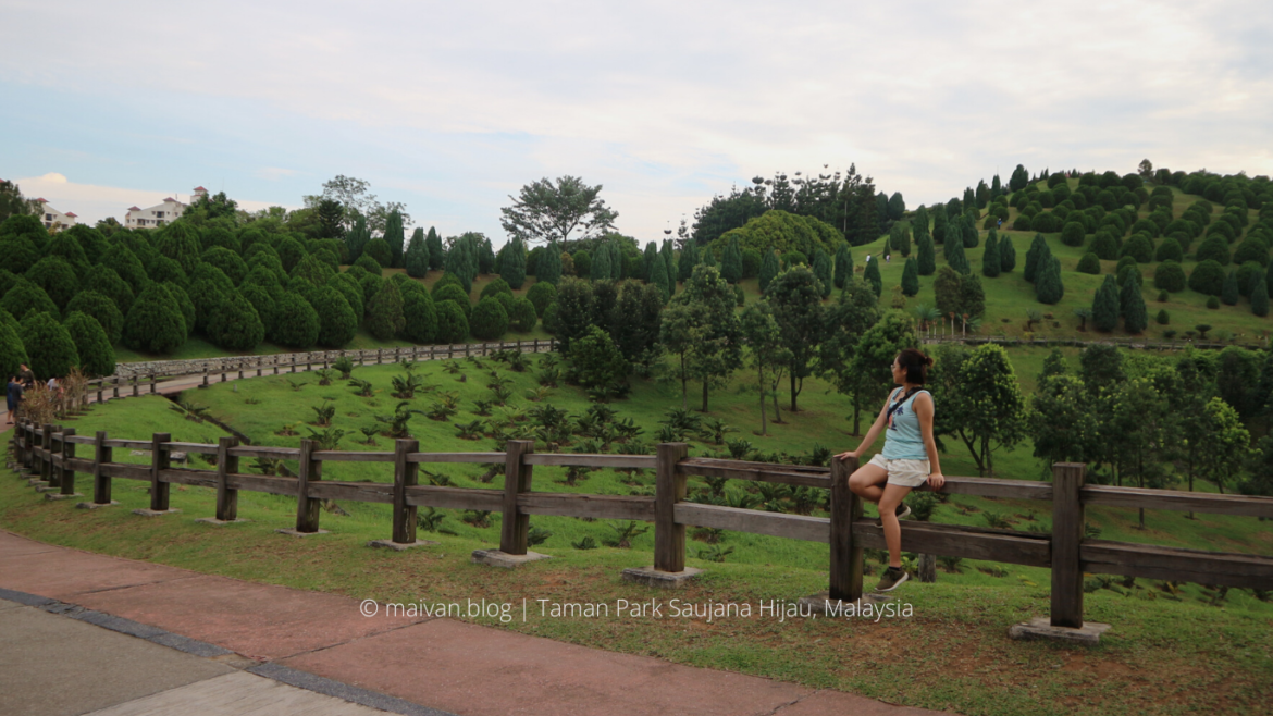
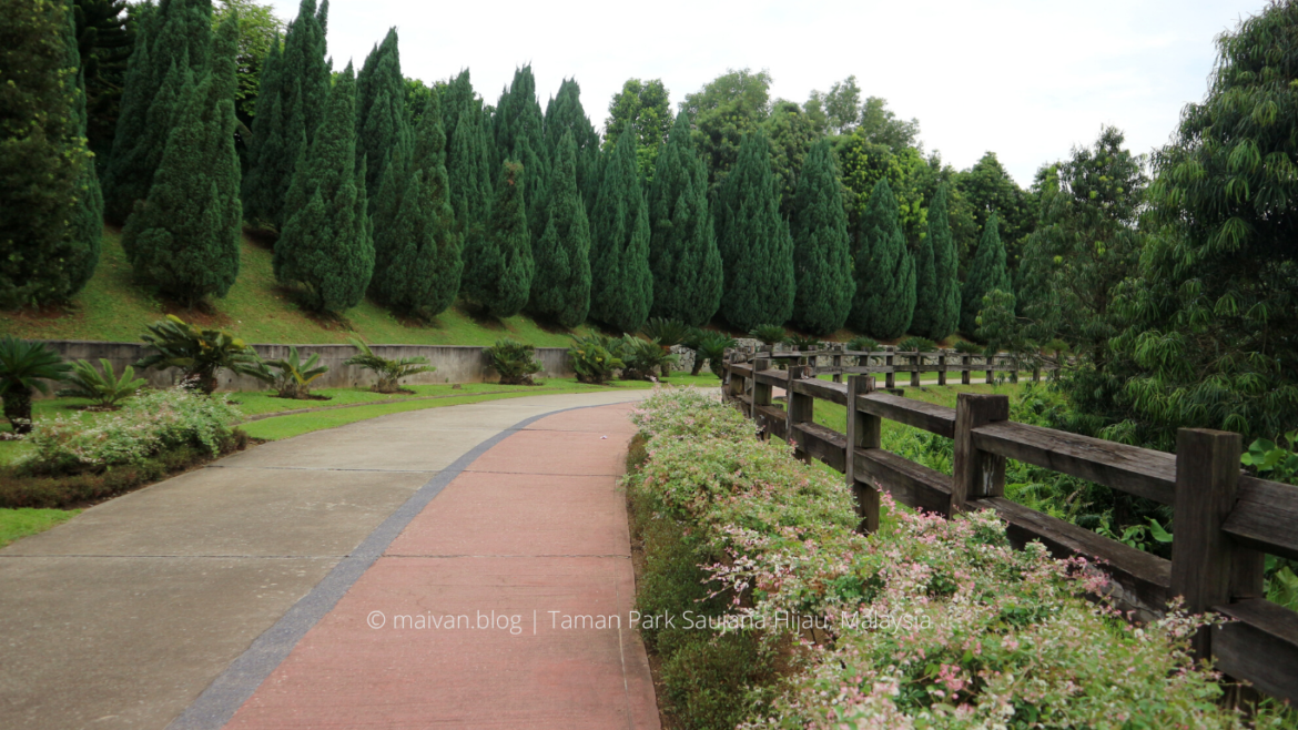
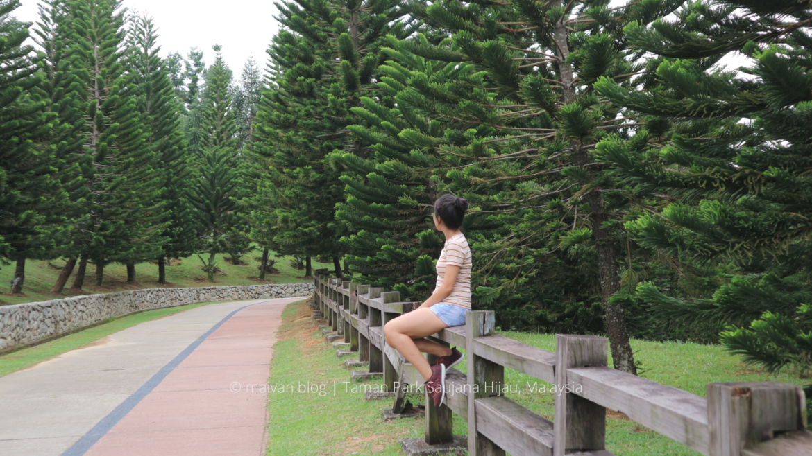
#11 Taman Park Saujana Hijau
- Location: Jalan P11, Presint 11, 62000 Putrajaya, Wilayah Persekutuan Putrajaya.
- Open: 7AM – 7PM every day.
- Level of trek: Easy
- Activities: picnic, jogging, running, photography, family gathering
- Entrance fee: Free (2019)
- Facilities: large outdoor parking space, many different entrances – GPS coordinates here LINK .
- How to get there: we travelled by grab from Bukit Jalil, it took us just around 20 minutes to get there.
- Best time to visit: visit in the early morning to watch sunrise or in the evening to catch sunset.
Taman Saujana Hijau has recently become a famous attraction which appeals to many locals and foreigners to visit. It is a perfect trail for morning or evening jogging and a wonderful picnic spot to spend quality time with family and loved ones at weekends.
The place covers 41 hectares of magnificent landscape in the middle of Putrajaya, and you will never get disappointed when walking in Taman Saujana Hijau as there are various different kinds of trees and blooming flowers in the park. It also offers visitors a breathtaking view of pine trees and Cyprus trees hills and the wonderful panoramic view of its surrounding areas. Moreover, the beautiful wooden fence trails create an atmosphere like you are in the middle of a foreign land.
The park is sectioned into 3 different pavilions: the European Garden, the Oriental Garden, and the English Garden. The European Garden lies in the highest of the hills which offers the magnificent view of the below trails and Putrajaya. Spending a few hours exploring this park is a great way for you to unwind and recharge your batteries as well.
Check out more pictures of Taman Park Saujana Hijau
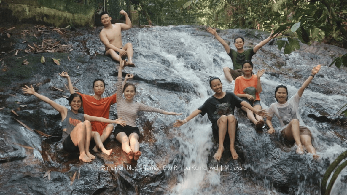
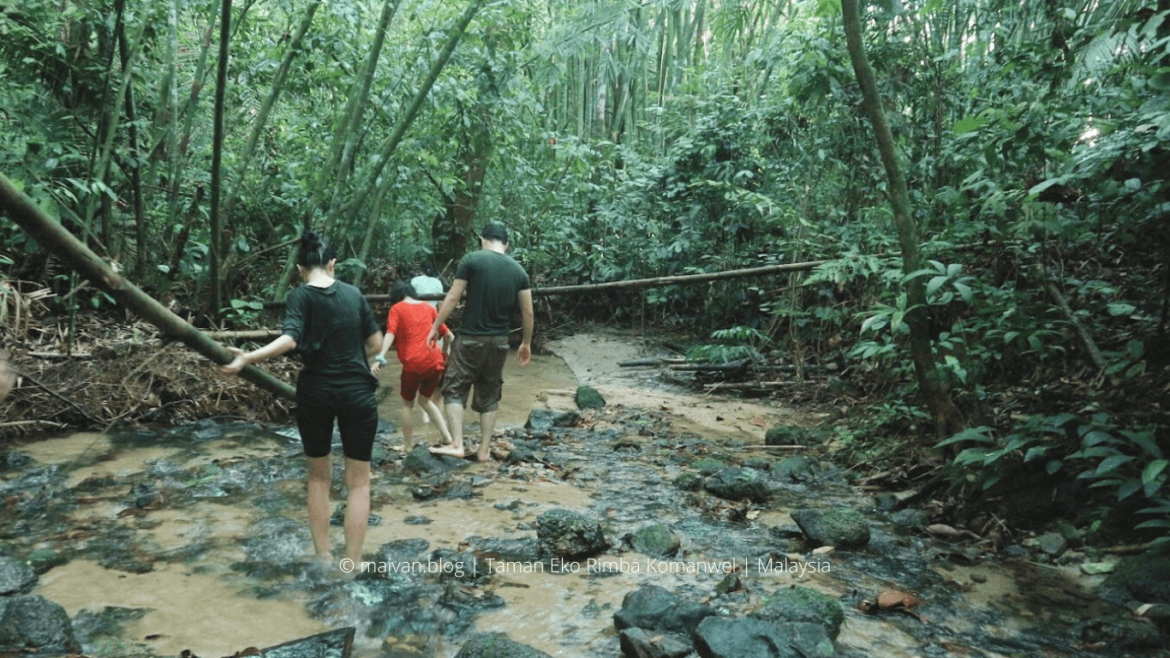
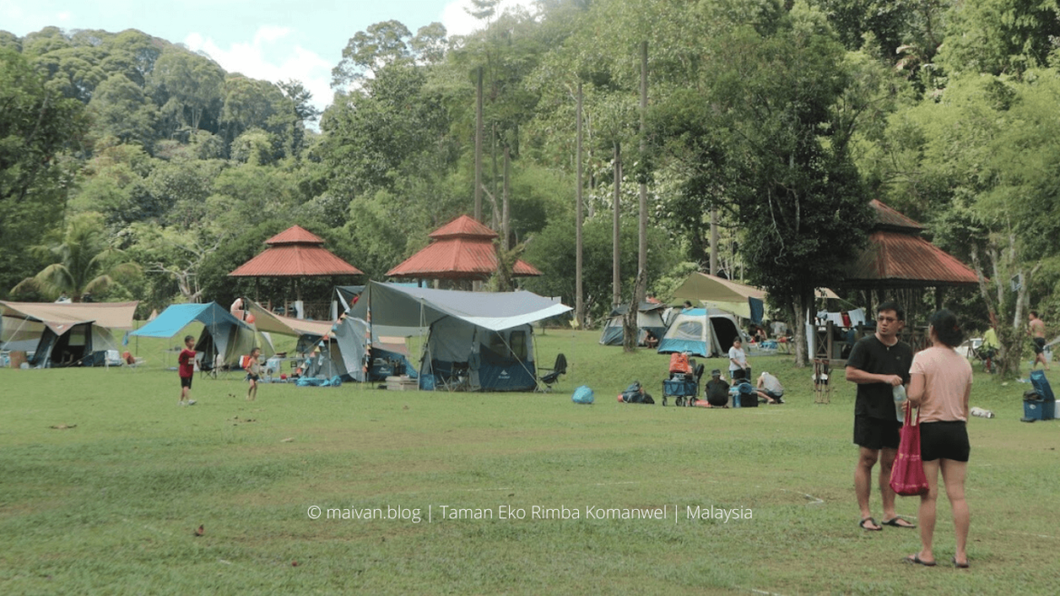
#12 Taman Eko Rimba Komanwel
- Campsite: Resort Taman Eko Rimba
- Distance: only 30 minutes drive from KL Sentral
- Check in – Check out: 9AM -12PM
- Facilities: Café, restaurant, washrooms, shower rooms, chalet hotels, prayer rooms, camping spots.
- Activities: Camping, trekking, hiking, exploring the waterfalls, jogging, ATV Riding, Kayak paddling, cycling, swimming, picnic.
- Contact: 012-276 1609
- How to go: You can get there by your own vehicle or using Grab/Taxi since it is just about 30 minutes from KL Sentral.
Taman Eko Rimba Komanwel is actually a camping site where you can at the same time discover the jungles and trek to the beautiful waterfall here. Taman Eko is a beautiful park covered with the dense forest around. It is a perfect place to spend your weekend in midst of nature, to unwind and recharge your energy.
There is a variety of trekking trails available for different stamina levels and ages. But most campers prefer vacation camping rather than exploring the jungle. If you are adventurous, trekking and exploring the jungle should be on your checklist. There is some interesting and challenging trail for those who are looking for a vigorous workout. You can expect to go through a few obstacles including steep slopes, root climbing, rock climbing, or muddy trails. For some parts of the trail, we have to use our hands to fight off branches and trees.
The trail was a bit slippery; leaches and mosquitos are among the hazards especially after rain. Many members of my team were bitten by leaches. They are not too dangerous or painful actually, they are just creepy.
Don’t forget to fulfill your itinerary with an amazing experience of exploring the mystery waterfall hidden within the forest, sweeping yourself into the cool water, and enjoying the nature spa-like machine. There are 2 parts of the waterfall; the first is a mild stream with water gushing over large boulders. Before reaching the waterfall, allow yourself to be distracted by the beautiful and chilling stream and the surroundings. Follow the stream to the end, the place offers a large wading pool and a beautiful waterfall providing you a perfect place to swim and relax. It is an easily accessible waterfall, we saw some small kids exploring the fall with their families.
The water is crystal clear, the fall is calmly flowing, the sun rays are shining through, everything creates a perfect nature masterpiece. You can climb up the rocks and pick a spot to chill.
Check out more pictures of Taman Eko Rimba Komanwel
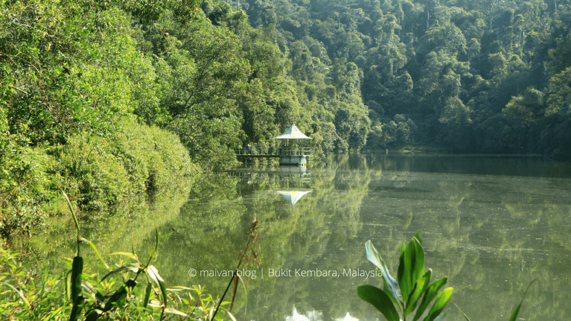
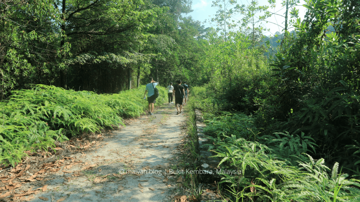
#13 Bukit Kembara
- Elevation: roughly 245 meters above sea level (>800 feet)
- Location: Ulu Kelang, 68000 Ampang Jaya, Selangor
- Entrance Fee: Free
- Level of trek: Easy to moderate. It can be a bit extreme for beginners since there are some steep paths, but it is a short trek, worth trying.
- Estimated time: 30 – 40 minutes one-way
- Facilities: no public toilets, no parking. I might have to find the parking lot in the nearby area.
- Activities: trekking, photography
- How to get there: Car/ Grab. You can go by LRT to Dang Wangi LRT station and catch a Grab there. There is a bus stop near the trail entrance, but I haven’t tried.
- Start point: The trail begins behind the red shrine, opposite Emerald Hill Condominium.
Bukit Kembara is a good place for a short weekend trek. I would recommend this trail to anyone who wants a short getaway from the hustle and bustle but does not want to travel too far. Bukit Kembara attracts many casual trekkers not just for the hill itself but the tranquil and picturesque Ampang Reservoir.
The trail is a bit steep at the beginning and then fairly flat at the peak. There are marked signs on the way and supporting ropes are available at the steep trails for you to hold on to on the steeper paths. In just about 15-25 minutes, you will reach the summit. But Bukit Kembara peak is nothing much, there is no view at the summit, just a few benches for resting and a couple of makeshift shelters. So keep trekking to the lake Ampang Reservoir.
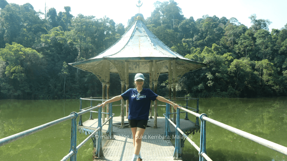
The path to the lake is also a bit steep, but in just about 10-15 minutes, you will reach the beautiful lake which offers a spectacular view. And the old hut in the middle of the lake is the great check-in spot and the highlight of Bukit Kembara. On the way back, when walking around the lake, you have the chance to pass a mini waterfall near the hut.
If you are a beginner, Bukit Kembara is worth trying, it will offer you an excellent trekking experience.


What do you think?